

OUR TEAM

Dr. Nasem Badreldin
Principal Investigator
Dr. Nasem Badreldin is an assistant professor in digital agronomy. He received his Doctorate of Science in Geography from Ghent University (UGent) in Belgium (December 2013), and his M.Sc. in Physical Land Resources from the Faculty of Bioscience Engineering in UGent (September 2008). He worked as a Postdoctoral Fellow at the Center for Earth Observation Sciences (CEOS) in Dept. of Earth and Atmospheric Sciences at the University of Alberta in Canada, and at the Dept. of soil science at the University of Manitoba and the University of Guelph in Canada. He is a professional in soil erosion modeling using machine learning algorithms, big remote sensing data, advanced spatial statistics.

Research Associates
Dr. Zeinab Alsadat Dastgheib
Dr. Zeinab Alsadat Dastgheib (P.Eng.) is a Research Associate at the University of Manitoba with interdisciplinary expertise spanning machine learning, signal and image processing, and advanced data analysis. She holds B.Sc. and M.Sc. degrees in Electrical Engineering and a Ph.D. in Biomedical Engineering.
While her earlier research focused on biomedical applications—specifically diagnosis and treatment monitoring for neurological disorders—she has successfully bridged her data analysis expertise into environmental science since 2018. Her current work in the Department of Soil Science focuses on data-driven environmental modeling, spectroscopy, and the development of Manitoba’s Soil Spectral Library (MSSL) to support precision agriculture and scalable soil monitoring.
Dr. Dastgheib has led multiple clinical trials and environmental research projects, published over 40 peer-reviewed papers, and possesses extensive experience in research coordination, teaching, and mentorship.

Ehsan Chatraei Azizabadi
PhD Student
Ehsan Chatraei Azizabadi is a PhD candidate in Digital Agronomy in the Department of Soil Science at the University of Manitoba, working with the Digital AgroEcosystems Lab. His research focuses on developing remote sensing-based diagnostic frameworks for precision nutrient management under Manitoba field conditions. His work integrates UAV multispectral imagery, UAV LiDAR, VNIR-SWIR hyperspectral sensing, satellite imagery, and machine learning/deep learning approaches to improve in-season nitrogen assessment, crop monitoring, and yield prediction.
Across multiple field seasons, Ehsan has coordinated plot-level agronomic measurements, UAV missions, field and laboratory data collection, data quality checks, and multi-sensor data processing workflows. His experience connects field trial operations, sensing technologies, data analytics, student and collaborator training, and knowledge transfer. He has trained students and researchers in UAV mission planning, remote sensing data collection, field safety practices, hyperspectral measurements, and data processing routines, and has presented his work at national and international conferences in soil science, remote sensing, geoscience, and digital agriculture.

PhD Student
Abdelrahman Saleh
Abdelrahman Saleh is a PhD student in Digital Agronomy in the Department of Soil Science at the University of Manitoba, working with the Digital AgroEcosystems Lab. His research focuses on Geospatial Crop Yield and Rotation Modeling

Sijan Kafle
Msc Student
Sijan Kafle received her bachelor’s degree in agriculture from the Institute of Agriculture and Animal Science, Tribhuvan University, Nepal. She is currently pursuing her master’s degree in Soil Science at the University of Manitoba. Her research focuses on the detection and severity assessment of early blight in potato, including the asymptomatic stage of the disease, using VIS-NIR hyperspectral imaging and machine learning techniques. Her work aims to improve early disease detection and monitoring for sustainable crop management. Her research interests include disease detection and monitoring in real farm fields using innovative imaging, sensing, and data-driven technologies to support precision disease management and sustainable agricultural production.
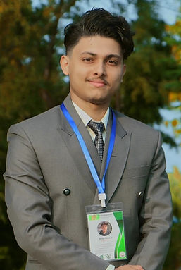
Anup Dhakal
Msc Student
Anup Dhakal is a MSc student in Digital Agronomy in the Department of Soil Science at the University of Manitoba, working with the Digital AgroEcosystems Lab his research sits at the intersection of satellite remote sensing, geospatial data science, and artificial intelligence applied to agriculture. His primary areas of focus include:
- Multi-temporal satellite image processing for crop monitoring
- Machine learning and AI-based crop yield prediction
- Precision agriculture and digital farming systems
- Geospatial analysis using GIS platforms and Python-based tools
- Integration of government agricultural datasets with Earth observation data
- LiDAR and high-resolution DEM processing for agricultural terrain characterization
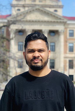
Dinuka Gayantha Thennakoon, Thennakoon Mudiyanselage
Msc Student
Dinuka Gayantha Thennakoon received his bachelor’s degree in Agricultural Resource Management and Technology with a specialization in Soil Science from the University of Ruhuna, Sri Lanka. He is currently pursuing an MSc in the Department of Soil Science at the University of Manitoba and is a member of the DA Lab. His research focuses on advancing soil organic carbon estimation in Manitoba through the integration of soil spectroscopy, remote sensing, and machine learning techniques. He works with proximal sensing technologies, including ASD FieldSpec and portable spectrometers, to develop efficient methods for soil assessment and environmental monitoring. His research interests include soil spectroscopy, remote sensing and GIS, machine learning applications in environmental science, precision agriculture, and sustainable land management.
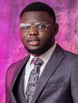
Emmanuel Ademola Okanlawon
Msc Student
Emmanuel Ademola Okanlawon holds a Bachelor of Agriculture in Agricultural Extension from Kwara State University, Nigeria, and is completing a Master's in Sustainable Land and Water Management at Ghent University. His research applies satellite remote sensing, geospatial analysis, and machine learning to agricultural drought and soil-moisture monitoring, currently focused on rotation cropland in Manitoba's Red River Valley with DA Labs, University of Manitoba. He works with MODIS, SMAP, and Sentinel-2/Landsat data, cloud-based tools such as Google Earth Engine, and in-situ soil-moisture networks for validation. Coming from an agricultural extension background, he maintains a strong interest in turning agricultural data into important information usable at the scale farmers and policymakers work.

Umar Farouk Mohammed
Msc Student
Umar Farouk Mohammed is a technical specialist in horticulture and crop management with over six years of experience in vegetable production, greenhouse technology, irrigation, and precision agriculture. He holds a B.Sc. in Agriculture Technology from the University for Development Studies, Ghana, and is currently pursuing an M.Sc. in Sustainable Land Management (Land and Groundwater Management) at Ghent University, Belgium.
Umar's expertise spans open-field and protected cultivation systems, agricultural mechanization, drone-assisted crop management, and sustainable land-use practices. Passionate about soil health and sustainable agriculture, his research interests focus on soil fertility restoration, nitrogen fixation by indigenous cover crops, sustainable land management, and the interactions between agriculture, soil, and groundwater systems.

Student Research Assistant
Maximilien Oosterhuis
Maximilien Oosterhuis is a Fourth-Year applied Computer Science student at the University of Winnipeg and a summer researcher with the Digital Agroecosystems (DA) Lab. His work focuses on developing an automated soil core imaging system integrating a motorized XYZ stage and RGB camera for high-resolution soil core imaging, contributing to a publicly available soil dataset.
.jpg)
Student Research Assistant
Syed Kumail Hassan
Syed Kumail Hassan is a third-year Computer Science student at the University of Manitoba and a summer researcher with the Digital Agroecosystems (DA) Lab. His work focuses on the intersection of software engineering and digital agronomy, with a primary objective of building foundational digital infrastructure for agricultural research. He is currently spearheading the development of the Manitoba Soil Spectral Library (MSSL), where he is engineering automated, FAIR-compliant data pipelines to standardize and catalog complex VIS-NIR and MIR spectroscopic soil data. By leveraging his expertise in full-stack development—including Python, Java, and database management systems like PostgreSQL/PostGIS—he is creating a scalable architecture that bridges the gap between raw spectral measurements and accessible, machine-readable datasets. His research interests lie in the development of robust database infrastructures, the application of Human-Computer Interaction (HCI) principles to technical data visualization, and the design of secure, tiered-access systems for sensitive geospatial information.

Dr. Barbara Kishchuk

Adjunct Lab Member
Dr. Ali Youssef
Adjunct Lab Member
Former Lab Members
Postdoctoral Fellow

Dr. Maliheh Rabie

Dr. James Biney
Graduate Researchers

Mirmajid Mousavi

Victoria Walker

Anmol Chopra

Weslei Augusto Mendonca
